Preparing for your excursion
The Great Crossing of the Alps
From July to September …
These are the most suitable months to enjoy the GTA: the stopovers are open and from mid-July there is no more snow on the passes (except in exceptional years). Therefore an ice ax and crampons are not necessary, and anyone can follow the route. October is also a great month for crossings (for those who can), but not all stopovers are open.
along footpaths and bridleways …
The whole GTA unfolds along mule tracks and easy trails, never too exposed. It is less dangerous to walk along a GTA path than … a city street, but a little care is still needed.
that are well-marked …
The route is marked with red and white marks frequently painted on rocks, walls, trees and the GTA flag at crossroads, in the less obvious parts and all along the trail.
from valley to valley …
This is the characteristic of the crossing: from the valley floor you reach a pass and then descend into a new “unknown” valley. It is therefore important, especially downhill, to follow the marked path, in order to reach the stopover without any problems.
sleeping in the stopovers …
The stopovers are a structure that was “invented” by the GTA, following the example of the French Grande Traversée des Alpes.
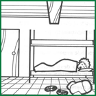
- Located in small villages or mountain pastures, they offer lodgings for 1 to 2 nights in dormitories with bunk beds; they are equipped with a kitchen in which it is possible to prepare breakfast and eventually dinner.
- In the vicinity of the stopover you can often find a “trattoria” (restaurant) that offers special prices, where you can have lunch or dinner, and a grocery store to buy food for your packed lunch.
- The stopovers were realized with the collaboration of the managers who live in the village and of the “Comunità Montane” (Mountain communities): they are undergoing progressive improvement and in some cases the rooms are still a little spartan. This is however compensated by the welcome of the local mountaineers and a direct encounter with their life.
- It is not possible to stay more than 2 consecutive nights in each stopover, since they are structures at the service of the “passing” hikers.
- You don’t need to book your place beforehand, but it is essential to call every night from one stopover to another, to inform of your arrival. (If you want to use the stopovers in other seasons it is good to agree in advance with the manager).
- In each stopover you will fill in a GTA sheet for comments and criticisms on the trail and the stopover: we invite you to solve any minor problems with the manager on the spot (call or write immediately to the GTA Association only in case of serious management deficiencies)..
- Do not be afraid of crowding problems: for the moment there have never been any, and the manager would however find accommodation for everyone in homes (or barns) of the village …
Or in the refuges …
In some cases refuges of the Club Alpino Italiano (Italian Alpine Club) are used as overnight shelters.
- The rates are similar to those in the GTA refuges only for members of the C.A.I. (Italian Alpine Club), while non-members pay more: this is another good reason for joining the C.A.I.
- In the refuges too it is important to call to inform of your arrival, and the GTA sheet is handed out for comments and criticisms.
- ln the case of management problems, write to the section that owns the refuge (or to the GTA Association).
… or in a tent.
The GTA is basically a trek where you will stay overnight in equipped cabins instead of in tents.
- However, if you prefer the weight, the problems and the autonomy of a tent, remember not to camp in the valley floor or close to the villages where land is still farmed, and to come to an agreement with the shepherd before pitching your tent in a pasture.
- In case of bad weather you can find hospitality in the stopovers.
To organize a holiday on the GTA
A minimum of training
The best way to train for crossings is … hiking throughout the year: in the spring short weekend trips on the trails, climbing progressively higher as the snow melts. Winter can be dedicated to ski tours, cross country skiing, snow shoeing or walking among hills and woods at low altitude … Even the GTA trails can be a great training ground: it is enough to give up the “crossing” and follow downward within the same day the path that led you up … A certain level of fitness is essential for you to experience the GTA as a great holiday and not as a battle with the Alps and with yourself.
Studying the path
Everyone, according to their taste and the amount of time available, can choose the section of the GTA they want to follow, for a simple weekend or their whole summer holiday. A rainy Sunday may be the right time to sit down and prepare your itinerary:
- Refer to the schematic map.
- Choose the trails that you want to follow by reading the descriptions.
- Study the train and bus schedules to connect with your points of departure and arrival by using the timetables (if you are arriving in Piedmont from far away, you can use your car up to Turin, or to a town that has bus connections with the valleys you want to walk through).
- Check the locations in which you will buy your food: it is important to minimise the weight of your backpack by purchasing food in stores from day to day, or asking for packed lunches in the “trattorie” (restaurants), but in some cases for 1 – 2 stops you will not find any shops so you need to plan your purchases accordingly.
- Finally, check your clothing and try to fit everything into your backpack …
What to put in your backpack
Dressing for a summer crossing along paths does not require anything special, except for the footwear: waterproof walking shoes or boots, woollen socks.
Each person must have a backpack that is convenient to carry, and with several pockets in which to store all the equipment; it is good to not have items dangling off the backpack or carried by hand, except a camera.
For the cold: 2 woollen sweaters worn one over the other, a K-Way, a woollen bonnet; for the rain: umbrella and poncho; for the Sun: light headdress, sunglasses and sun cream; for the night: a liner or a light sleeping bag (military sleeping bags will not do, they are bulky and heavy) or sheets, a battery lamp with a spare bulb; a change of night clothes and a piece of Marseille soap (you can wash your laundry along the way).
Collective material:
for orientation: a description of the itinerary, a scale 1: 50,000 map, a compass; multi use knives; for emergency repairs: needle and thread, scissors, safety pins, string, a roll of tape, soft iron wire; first aid with: snake bite serum, elastic band, antiphlogistic ointment, adhesive bandages, disinfectant, gauze pads, an assortment of useful pills …; one thermos flask for every 2-3 people or a trek cooker with windproof matches; one flask for every 2-3 people. Food: according to your taste and the distance from grocery stores and restaurants.
Before leaving
A few days before leaving, call the first 2 – 3 places where you plan to stay overnight, to check their availability.
On the trails of the GTA(i.e: the roadmap)
Everyone can organize each hike as they think best, but we shall however give you some advice.
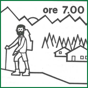
– wake up at dawn and have a light breakfast;
– set off at 7 the latest;
– climb peacefully, observing the landscape and environment that surround you.
– rest when you like along the ascent and eventually have breakfast halfway up, around 9;
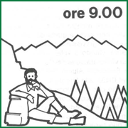
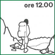
– reach the pass towards 12; have lunch on the pass and stop for a long time if the weather is stable; begin your descent if the weather is getting worse; it is advisable to reach the pass no later than noon: in the mountains during summertime the weather often worsens in the afternoon, with the formation of fog and brief thunderstorms;
– descend peacefully with eventual rests until you reach the stopover;
– buy food and settle in the stopover;
– call the next stopover to announce your arrival;
– have dinner and spend the night.
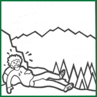
The next morning, if dinner was a bit generous, if it rains or if you are too tired, nothing prevents you from stopping for one day to rest or take a walk around (but let the next stopover know about your delay, otherwise they will send out the mountain rescue team to look for you!)
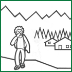
The path is there but you cannot see it (i.e.: when fog settles in)
In the afternoon hours you may sometimes find yourself in fog, or rather among low-altitude clouds. In that case, you should take some precautions. Locate on the map the main direction of the path and check with the compass that you are keeping that direction. Never lose the marked trail. This is how to proceed: one member of the group stops at the mark while the others continue without going too far until they find the next mark: at this point they call to “the man at the mark” so that he would join them, stop at the new mark and so on. If the group does not find the mark right away, they can go back to the mark-man (whom they locate by his voice) and start looking in another direction.
The important thing is to never leave a mark until you have found the next one: in this way you will always have the certainty of being on the right path. If you lose the path you should however stop and wait for the weather to improve, or retrace your steps to find the path further up, rather than attempting a descent to the valley (as you descend, the ground usually becomes more rugged and impracticable).
In case of accident…
An accident during a hiking trip is less likely than a car accident but, unlike the latter, it occurs in a less frequented environment and where rescue is not easy.
For those accidents that cannot be remedied with a little first aid, it is best to avoid “making do on your own”, since incorrect transportation of the injured person downstream can seriously worsen their conditions. In the mountains, a person who is even slightly injured finds himself in a state of great frustration and physical but above all mental debilitation and is much more vulnerable to the cold and adverse weather conditions. It is therefore necessary to remain calm and, if possible, transport the injured person to a nearby sheltered place; spread it out, isolating it from the ground with waterproof clothing and cover it with all the clothing available, avoiding giving alcoholic beverages for any reason. The location of the accident must be precisely identified on paper; then, assuming you are in a group of at least 2 people, one will stay with the injured person with backpacks and clothes (he/she will have to cheer him up without dramatizing the situation), and if there is no telephone coverage the second person will necessarily have to go down to the valley, he can Perhaps along the route there is a telephone signal, so it is necessary to check your mobile phone every now and then to see if there is a signal and then call the single emergency number, 112 (it may be possible that a 112 Operations Center will answer even outside the Region but not is a problem, you will have to answer the questions they will ask you and they will take care of alerting the competent Operations Center of the area where the accident occurred). Once you reach the valley, if you do not have a telephone, go immediately to the first public place (every place it is normally an emergency call station) and raise the alarm by precisely explaining the location of the accident and the conditions of the injured person. (IT IS IMPORTANT TO EXPLAIN PRECISELY THE PLACE OF THE ACCIDENT AND THE CONDITION OF THE INJURED). It should be underlined that the greatest delay to help comes from not being able to indicate the location of the accident.
Maps
Although the trail is well marked, it is best to have a map of the area that you will cross. For your itinerary you can use the maps of the “Istituto Geografico Centrale” (IGC) (Central Geographical Institute) of Turin, also in scale 1: 50,000, in colour. The IGM tablets scale 1: 25,000 are more difficult to read, and each map covers a very limited area (10 x 10 km). The ground rises are shown on the maps with contour lines; where the curves are more dense the ground is steeper. The equidistance indicates the difference between two adjacent contour lines.
It is interesting to compare the real landscape with what appears on the map (properly oriented with the compass): this allows us to know the names of the mountains and surrounding places, and helps us understand the direction and the environment in which the trail winds. You can also find a place on the map by observing its real shape, and vice versa imagine a landscape only by looking at the map (this is useful for planning new trips).
Various advice
Paths are the most logical and convenient trail, tested over centuries: avoid shortcuts.
Meadows and pastures: do not walk over them off the path.
Slopes of dry grass: be careful, they are very slippery.
Waste: take it down with you (glass and cans are dangerous for animals, by the way).
Snow tongues in the valley: walk over them carefully, without slipping (they usually overlook a
watercourse).
Thunderstorms: do not stop on peaks, ridges, elevations, next to trees, streams and caves, but descend into the valley.
Vipers: you just need to pay a little attention to where you put your feet (or hands) and wear thick woollen socks and high neck shoes.
Off-road vehicles: do not waste time in arguments, but warn the forest rangers or ecological guards, or contact the municipal authorities (Town Hall), either personally or by letter, so that they would intervene.
Stones: be careful not to make them roll down the slope: you know where they start, but not where they stop and they can cause serious damage.
Cabins: if you happen to find one that is open and you need to shelter from the bad weather be sure to leave it as you found it, carefully avoiding to remove any object, even those that may seem forgotten or abandoned. The same goes for fruit plants and produce grown along the way.